
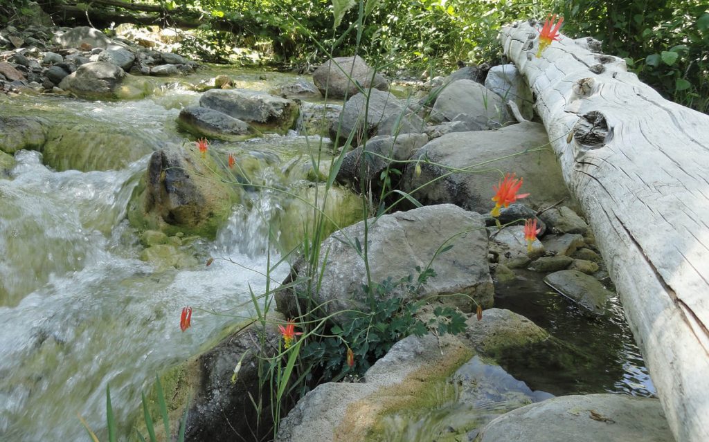
Crimson Columbine grace the fresh, tumbling waters of the East Fork of the San Gabriel River. This scene was photographed just downstream from Mine Gulch campsite at an elevation of 4,500′ in the Sheep Mountain Wilderness. It’s all boulder hopping downstream from the confluence of Vincent Gulch, Mine Gulch and the Prairie Fork.
There are at least twenty good reasons to hike Wrightwood during the spring and summer months. While the front country of the San Gabriel mountains swelters under the summer heat and high humidity, there’s a beautiful place in the eastern high country where the air is lighter, cooler and a bit drier, too. Gentle breezes sweep through the pine forests, imparting a restful, freshness to your hike. If you can imagine spanning the ridge top distance between Wright Mountain on the east out to Mount Baden-Powell in the west, there’s a myriad of hiking trails, over 20, to be found among the high elevation pines, fir, cedars and fragrant chaparral. Some of the trails connect places like Jackson Lake with West Blue Ridge, Wrightwood with East Blue Ridge and the Pacific Crest Trail (PCT), Big Pines with Blue Ridge Campground, Vincent Gap up to Mount Baden-Powell’s 9,399′ summit or the descent into the headwaters of the East Fork of the San Gabriel River.
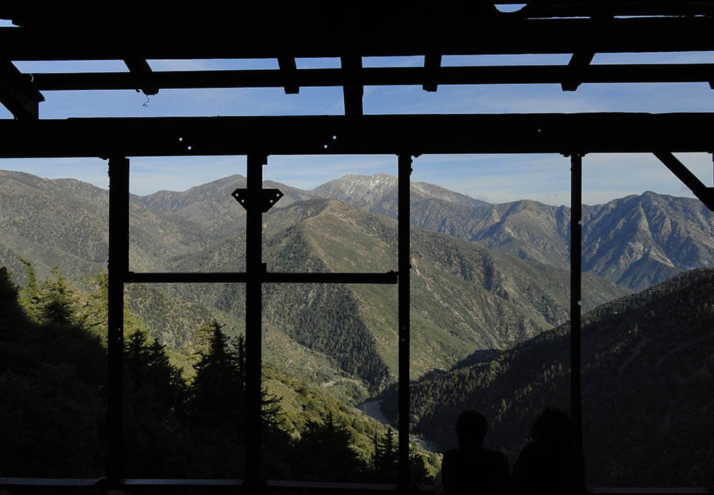
Old metal supports from the Big Horn Mine’s stamp mill provide this framed view of Pine Mountain, Mount Baldy and Iron Mountain. Thousands of feet below, the East Fork of the San Gabriel River churns through the Sheep Mountain Wilderness.
There’s quite a variety of places to hike Wrightwood that provide you with a sense of of our past, such as the remains of the Big Horn gold mine, which clings precariously to the slopes of Mount Baden-Powell in Mine Gulch. Dating back to the 1800′s, this hard rock mine was worked for decades by tenacious miners, in hopes of golden outcomes. Today its’ stamp mill and mine shafts sit idle, a testament to nature’s relentless taking back of the works of man in mountainous places.
If you look around the old Big Pines Lodge at the heart of what was once Big Pines County Park, founded in the 1920′s, classic rock work fringes rock walls and staircases from an era gone by. Walk the Big Pines Nature Trail or head down to the old ice skating rink near the Arch Picnic Area to catch glimpses of where cabins once stood amongst groups of campers and snow players.
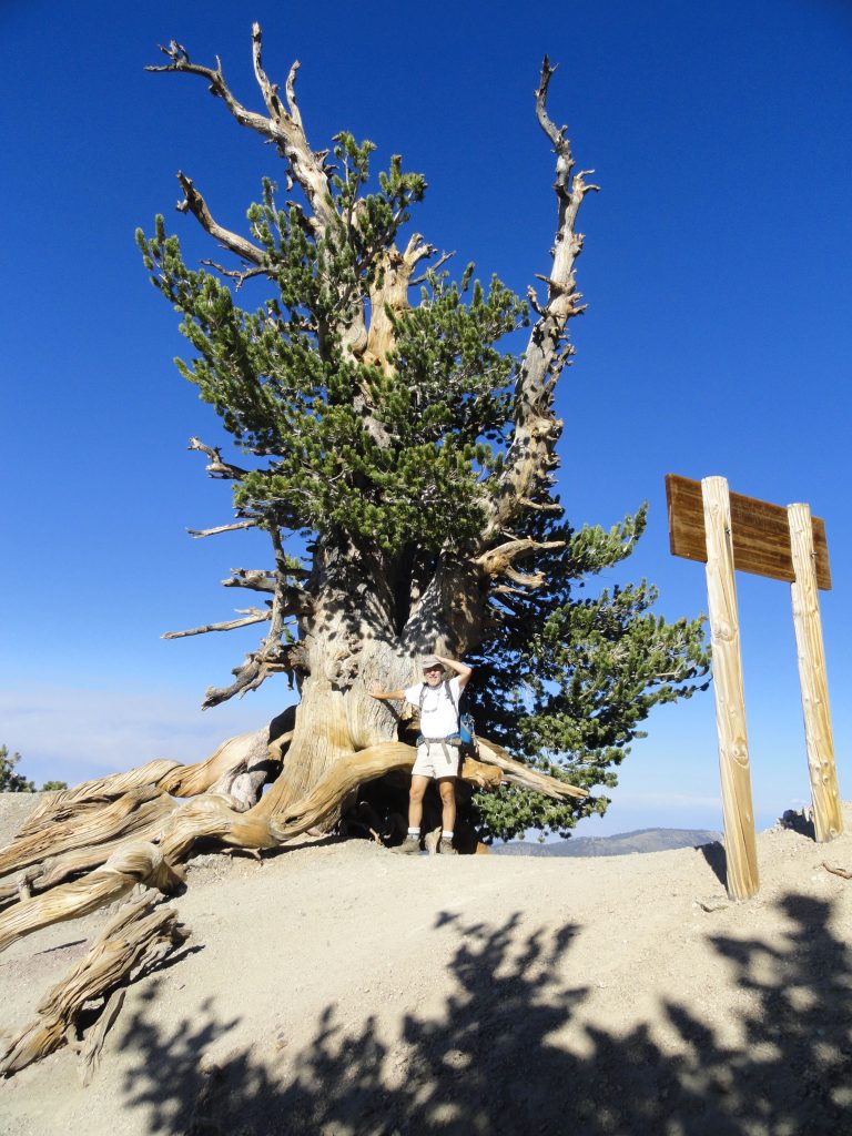
An ancient Limber Pine straddles the ridge top just prior to arriving at the summit of Mount Baden-Powell. Some of these beautifully gnarled pines are nearly two thousand years in age and are found near the upper end of the Pacific Crest Trail that connects Vincent Gap’s trailhead with the summit.
Hiking up to Mount Baden-Powell or dropping down into the canyons from Vincent Gap provide for a wonderful variety of terrain and plant life. Regardless of your conditioning and time available, there’s a trail here for you. If carrying a trail map appeals to you, there’s a large scale, hand-drawn map that highlights twenty hikes in the Wrightwood – Big Pines area of the San Gabriel mountains, providing a brief description of each hike experience with rise over run. The map is very accurate, easy to read and has been field checked throughout. Contour lines have been purposely omitted to provide a clear, uncluttered overview of the local high country trails. The Wrightwood – Big Pines Map is available online with free shipping or can be found at Mountain Hardware and the Wrightwood Market in the quaint village of Wrightwood, CA. Happy Trails from Chris at Canyon Cartography!
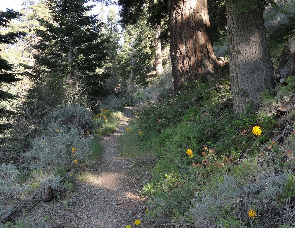
Heading back up the Manzanita Trail toward Vincent Gap. Western Wall Flowers and Indian Paint Brush signal the advent of the summer hiking season.